Jump to content
Posted

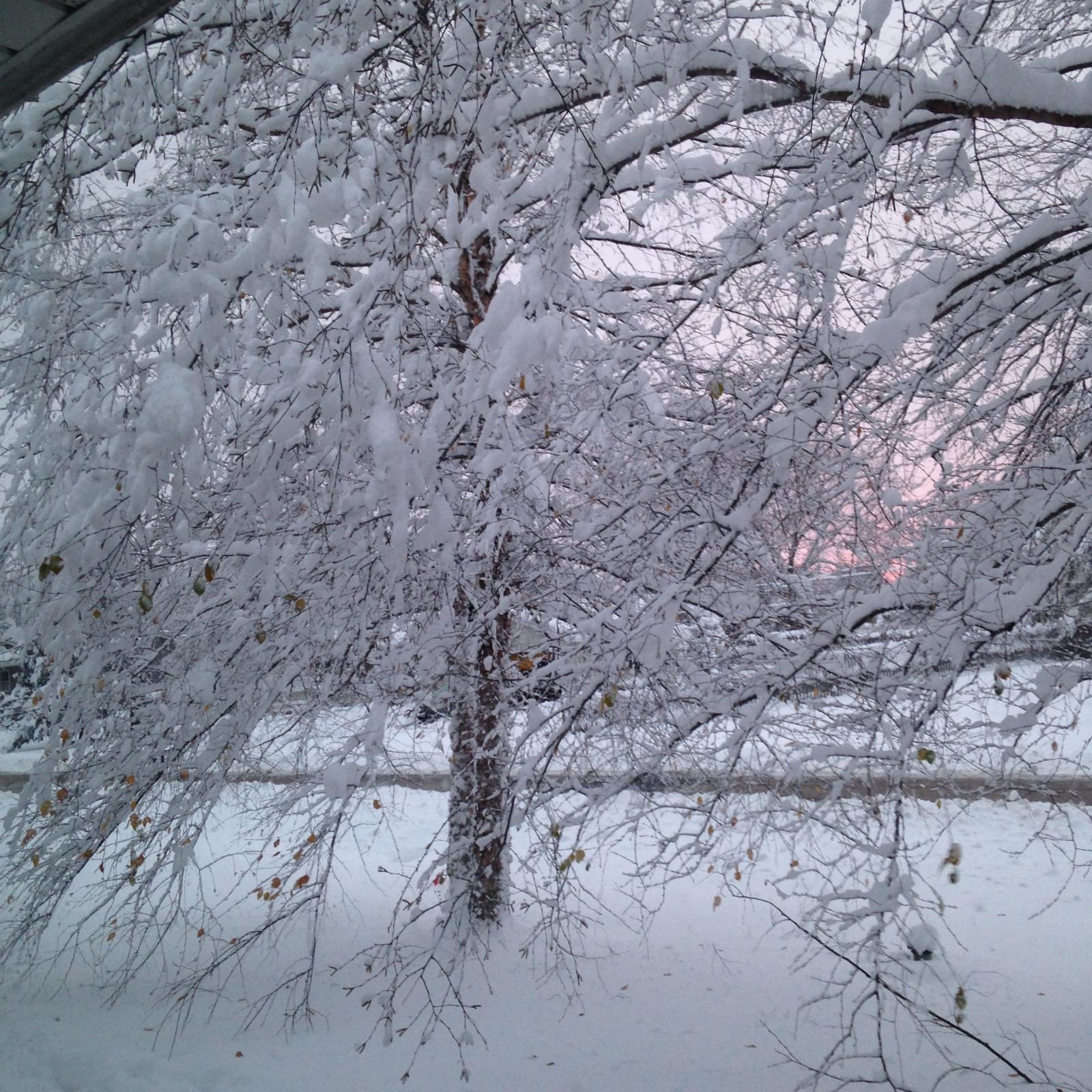
Started all as snow yesterday around 6:00pm.  Went to bed around 10:30pm with about 2" in the grass.IMG_0626.thumb.jpg.7d4e0f705a35821455a27

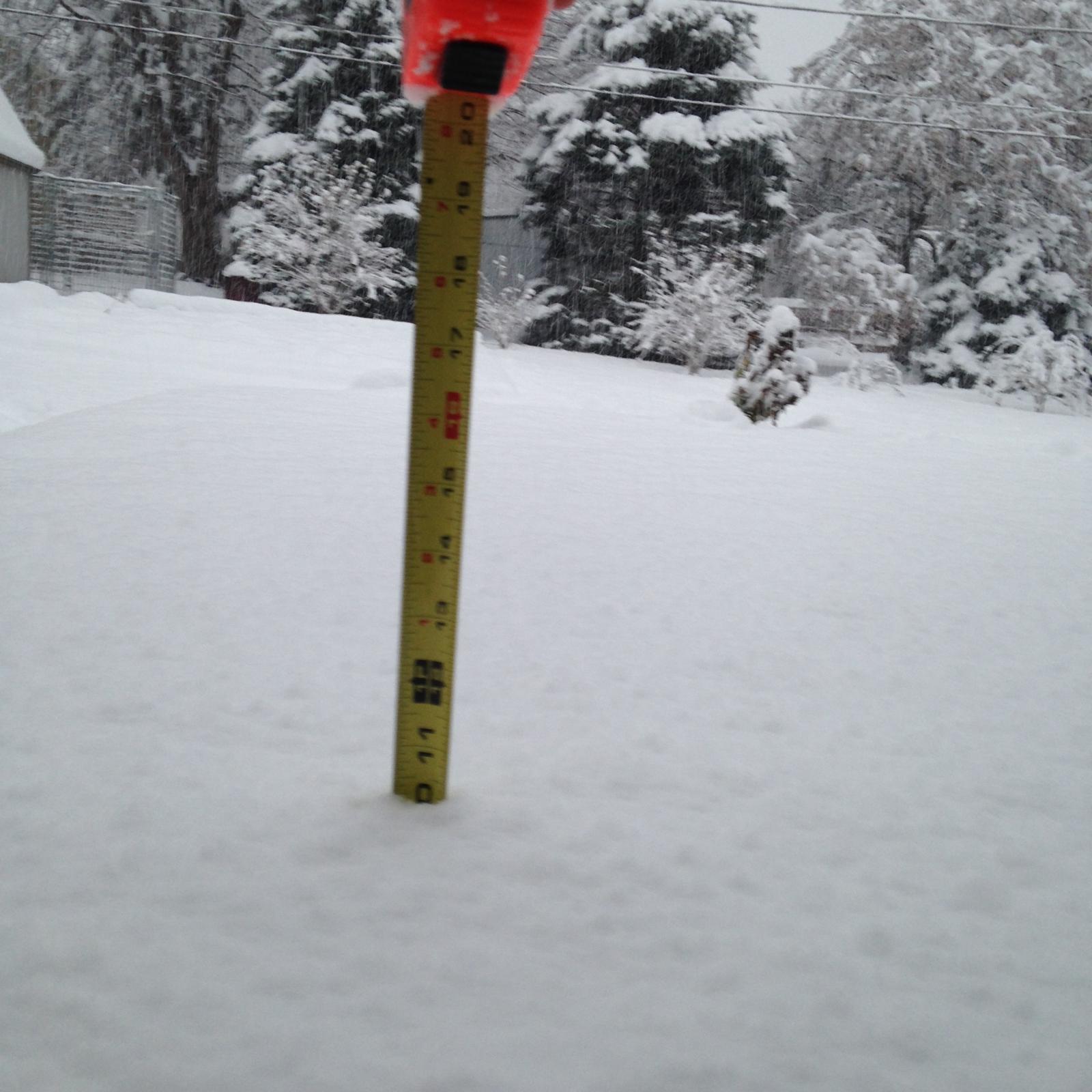
Woke up to this on my deck at 7:00am..................


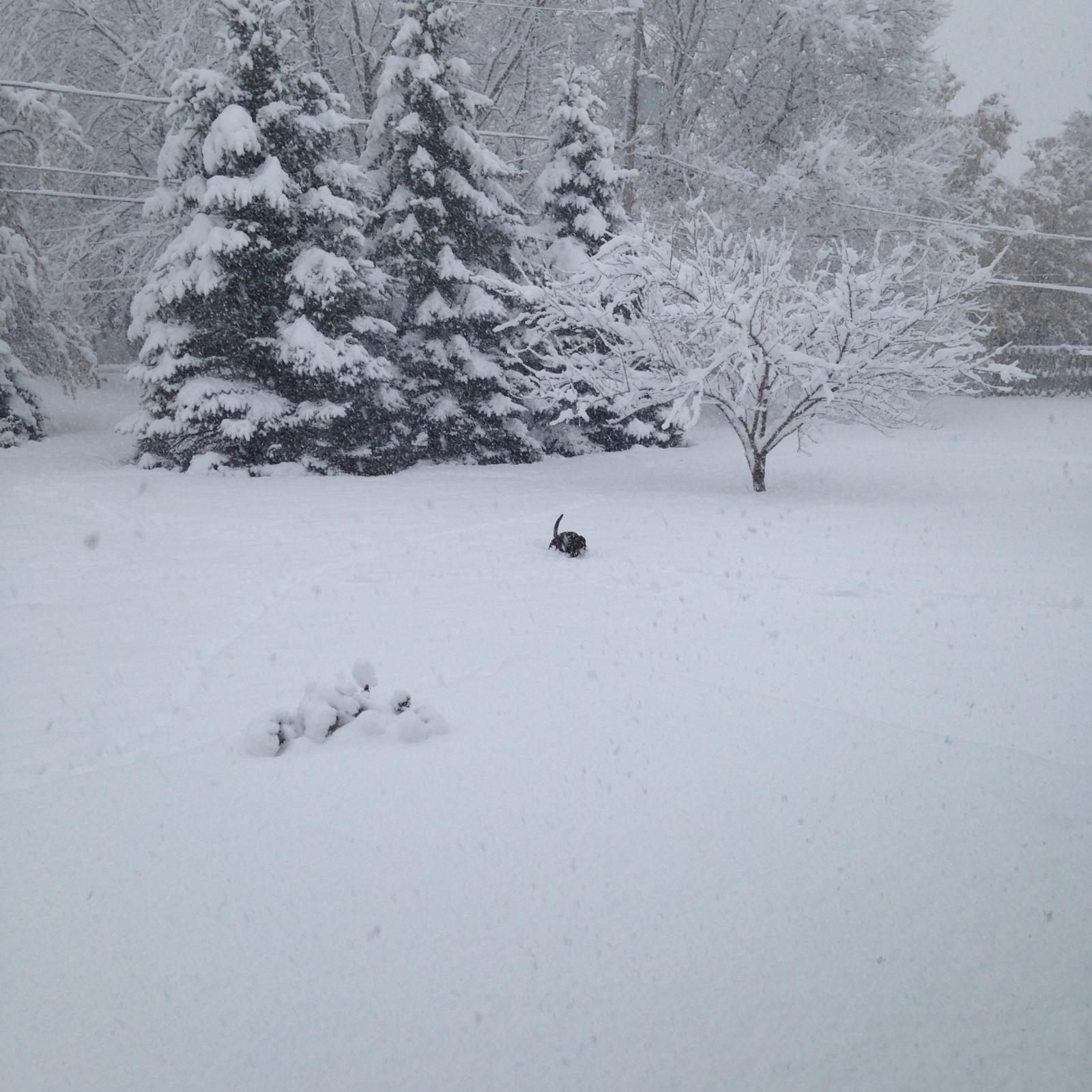
Here's one of my pooches "high-centered" in the back yard at around 10:00am........


And one of PegPeg "high-centered" in my back yard at around 10:00am!!


IMG_0627.thumb.jpg.f4ced27450877a42749e7

And now one after the "storm" has passed........................notice the "red sky at night", and my wellhead in the lower right corner of the picture.  The top of my wellhead is just below knee high...................IMG_0630.thumb.jpg.e73f3ce093dce2832b093

  • Replies 6
  • Views 1.7k
  • Created
  • Last Reply

Top Posters In This Topic

Most Popular Posts

  • Well, climate change causes terrorism... so, the only logical conclusion is to buy some guns.  

  • Be careful what you wish for .....you all might get slammed. Might need a 7 foot dia. culvert in front of your door to go out  my trucks down there somewhere'

  • The Boss in heaven might just give a real blessing of a winter... 'Thank you Boss, please show us who's really in charge down here'.

Posted Images

Featured Replies

Well, climate change causes terrorism... so, the only logical conclusion is to buy some guns.  :)

  • Staff

Be careful what you wish for .....you all might get slammed. Might need a 7 foot dia. culvert in front of your door to go out

 my trucks down there somewhere':omg:

Edited by JAG1

  • 3 weeks later...
  • Owner

LOL... Both trucks are put away in their garages. The ATV is fuelled up and ready for action.

Quote

URGENT - WINTER WEATHER MESSAGE
NATIONAL WEATHER SERVICE BOISE ID
102 PM MST TUE DEC 8 2015

...STRONG PACIFIC STORM LATE WEDNESDAY NIGHT AND THURSDAY...

.A STRONG PACIFIC STORM WILL COME INTO IDAHO LATE WEDNESDAY
NIGHT AND CONTINUE THROUGH THURSDAY.  THE STORM WILL BRING
SNOW TO HIGHER ELEVATIONS NORTH OF THE SNAKE RIVER BASIN AND
SIGNIFICANT ACCUMULATIONS ARE POSSIBLE.

IDZ011-013-090600-
/O.NEW.KBOI.WS.A.0003.151210T0600Z-151211T0000Z/
WEST CENTRAL MOUNTAINS-BOISE MOUNTAINS-
102 PM MST TUE DEC 8 2015

...WINTER STORM WATCH IN EFFECT FROM LATE WEDNESDAY NIGHT
THROUGH THURSDAY AFTERNOON...

THE NATIONAL WEATHER SERVICE IN BOISE HAS ISSUED A WINTER STORM
WATCH FOR THE WEST CENTRAL IDAHO MOUNTAINS AND BOISE MOUNTAINS
...WHICH IS IN EFFECT FROM LATE WEDNESDAY NIGHT THROUGH THURSDAY
AFTERNOON.

* SNOW AMOUNTS...6 TO 12 INCHES POSSIBLE.

* SNOW LEVELS...ABOUT 4500 FEET MSL.

* WINDS...SOUTHEAST 10 TO 20 MPH LATE WEDNESDAY NIGHT AND THURSDAY
  MORNING...THEN DECREASING TO 10 MPH OR LESS.

* TIMING...SNOW SHOULD BEGIN IN THE PRE-DAWN HOURS THURSDAY AND
  CONTINUE THROUGH THE DAY THURSDAY.

* IMPACTS...ROADS WILL LIKELY BECOME SNOW-COVERED AND HAZARDOUS
  FOR TRAVEL.

PRECAUTIONARY/PREPAREDNESS ACTIONS...

A WINTER STORM WATCH MEANS THERE IS A POTENTIAL FOR SIGNIFICANT
SNOW...SLEET...OR ICE ACCUMULATIONS THAT MAY IMPACT TRAVEL.
CONTINUE TO MONITOR THE LATEST FORECASTS.

Bring it on! :gun:

  • Staff

The Boss in heaven might just give a real blessing of a winter...:thumb1: 'Thank you Boss, please show us who's really in charge down here'.:pray:

Edited by JAG1